Model-based GIS and mapping software
AutoCAD® Map 3D software provides access to GIS and mapping data to support planning, design, and data management. Intelligent models and CAD tools help you to apply regional and discipline-specific standards. Integration of GIS data with your organization helps to improve quality, productivity, and asset management.
Features
Access GIS imagery, point cloud, and business data
With AutoCAD® Map 3D software, you can access and use CAD and GIS data from a range of sources. With comprehensive gas, water, wastewater, and electric industry data models, you can more easily organize disparate asset information and apply industry standards and business requirements.
Spatial and GIS analysis videos
Watch spatial and GIS analysis videos to learn how the tools in AutoCAD® Map 3D software enable you to visualize data in various ways through queries, buffers, and reports, so you can make more informed data decisions and streamline geospatial data management.
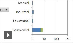
Analysis tools
Answer questions and make data decisions.
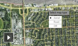
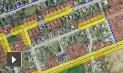
Coordinate systems and geolocation (enhanced)
Bring aerial information into your maps.
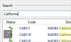
Create coordinate systems
Choose a coordinate system or create your own.
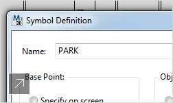
Create and edit symbols
Import and customize public-domain symbols.
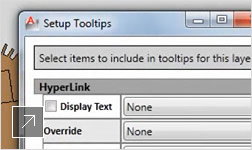
Dynamic tooltips and links
In-product tips and links aid productivity.
Model creation and management videos
Watch industry model creation and spatial database management videos to learn how AutoCAD® Map 3D software enables you to convert data to intelligent models, ease database management, define workflows and feature rules, and create, share, and analyze industry-specific models.
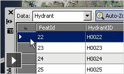
Data management tools
Model data is portable and customizable.
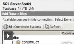
Access industry models in more formats
FDO enhancements enable SQL access.
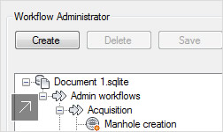
Workflows and feature rules
Customize feature rules for specific tasks.
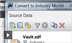
Convert data to intelligent industry models (enhanced)
Convert GIS and CAD data.
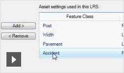
Configure linear referencing systems
Create an LRS model.
Industry model analysis
Identify connected facilities and analyze impact.
Publishing GIS maps online video
GIS maps online videos demonstrate how AutoCAD® Map 3D software enables you to share GIS data with more stakeholders. Extend beyond the desktop to get the right information to the right person at the right time and in the right format—paper, desktop, web, or mobile.

Take industry model data offline (enhanced)
Make changes locally; sync to desktop applications.
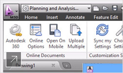
Desktop to web to Autodesk 360 (enhanced)
Easily share GIS maps online with Autodesk 360.
Publish directly to the web
Publish native DWG.
Interoperate with AutoCAD and GIS software
Choose from a variety of widely used GIS formats.
Data exchange with 3D planning/design tools
Use the same data for modeling in 3D environments
Dynamic legends, north arrows, and scale bars
Insert scale bars and other viewports.
Grids, graticules, and map books
Choose how you want to present your maps.
Topographical data demo videos
Topographical data demo videos and images demonstrate how AutoCAD® Map 3D software enables geospatial data management. Learn how to manage and import GPS data, gather existing conditions, and import field survey data.
Topographical data directly from the source
Access topographical data directly from the source
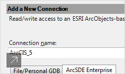
Data access and management (enhanced)
FDO provider for ArcGIS.
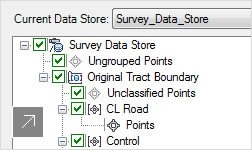
Survey functionality
Survey tools use data from a variety of sources.
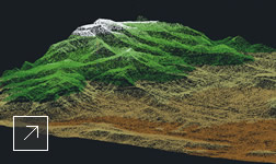
Surfaces and point cloud tools
Use points and contour data to create models.
Related Products